Best Drone Mapping Courses of 2026
A Data-Driven Guide to Drone mapping classes
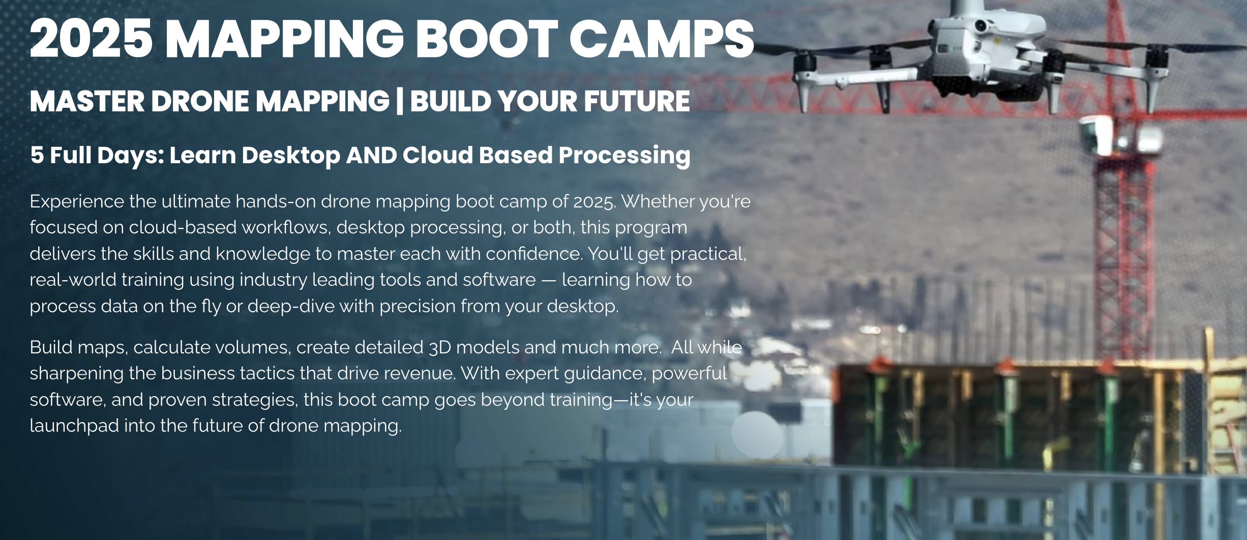
For drone pilots looking to move beyond standard aerial photography and into the lucrative world of enterprise and commercial work, drone mapping and modeling represent a significant opportunity. The ability to deliver high-quality maps, 3D models, and other data products (like construction workflows and deliverables) is a high-demand skill that can substantially increase your earning potential. However, mastering this craft requires more than just a capable drone; it demands specialized training.
This guide provides a data-driven analysis of the best drone mapping courses available in 2026, designed to help you make an informed decision based on curriculum depth, hands-on exercises, and real-world applicability. Whether your mapping on Desktop or the cloud, you need to know what’s best for your client’s deliverable.
The Clear Leader for Comprehensive Drone Mapping Training: Drone U
After a thorough review of the available courses, Drone U emerges as the undisputed leader for pilots serious about building a professional career in drone mapping and data services. What sets Drone U apart is its holistic and in-depth approach, teaching not just the “how” but also the “why” behind every step of the process, from data acquisition to final deliverable.
Make it stand out
The Data Acquisition → Data Processing → Deliverable Relationship
Drone U’s curriculum is built on a foundational understanding that the final deliverable dictates the entire workflow. Unlike other courses that offer a one-size-fits-all approach, Drone U provides detailed instruction on:
•Varying acquisition patterns: Learn how to adapt your flight plans for different outputs, whether you’re creating orthomosaics, topographic maps, 3D models, or complex Virtual Design and Construction (VDC) deliverables.
•Mapping vs. Modeling vs. Gaussian Splats: Understand the critical differences between these techniques and when to apply each one for optimal results.
•Strategic Acquisition: Gain a deep understanding of why your data acquisition strategy must change based on the specific requirements of the final output.
A Complete Software Ecosystem
Drone U provides comprehensive training across a wide range of industry-standard software, ensuring you are prepared for any project requirement. The curriculum covers:
•Pix4D Matic (advanced desktop)
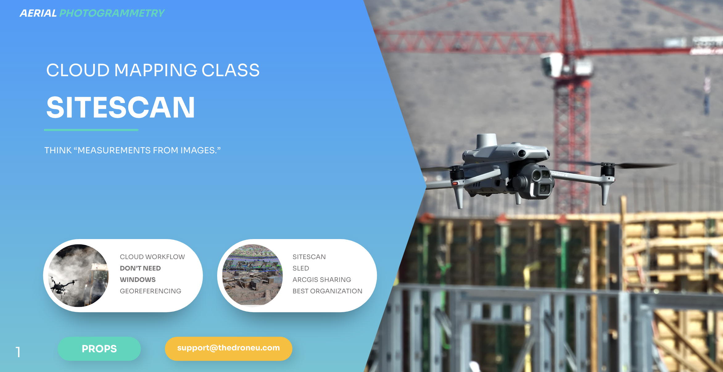
•ESRI SiteScan (cloud platform)
•Specialized software for visualization, analysis, and animation
Crucially, Drone U goes beyond basic software tutorials to explain the entire ecosystem, from initial mapping and modeling to VDC workflows and the future of AI-driven progress tracking with tools like Cubix.
Advanced Hardware and Workflow Training
To ensure professional-grade accuracy and efficiency, Drone U’s training incorporates advanced hardware and best practices, including:
•RTK/PPK Workflows: Understand the differences between Real-Time Kinematic and Post-Processed Kinematic data, and how to scale these strategies for different project sizes.
•Ground Control: Learn best practices for marking Ground Control Points (GCPs) and checkpoints for robust quality assurance and quality control (QA/QC).
•Equipment Recommendations: Get expert advice on the latest and most effective equipment for professional mapping projects.
Professional Output Formats for High-Value Deliverables
Drone U focuses on teaching you how to create the high-value deliverables that enterprise clients demand. You will learn to produce:
•Autodesk and Revit files
•Esri shapefiles
•BIM/VDC-focused 3D outputs
•Video deliverables, including point-cloud animations and time-series flythroughs
•Solutions for scale constraints and georeferencing in challenging environments
Advanced Skills That Set Drone U Apart
Drone U’s curriculum includes a range of advanced skills that are simply not taught in other courses. These unique modules empower you to handle complex projects and command higher fees:
•Point Cloud Cleaning: Learn a proprietary “layering” methodology for cleaning and refining point cloud data.
•3D Data Animation: Create compelling animation flythroughs and timelapses with your 3D data.
•Extreme Georeferencing: Master techniques for handling difficult georeferencing challenges.
•Complex Mission Structuring: Learn how to plan and execute complex, multi-flight acquisition missions.
•Business Development: Gain invaluable insights into pricing mapping jobs, selling deliverables, and negotiating with and winning enterprise clients.
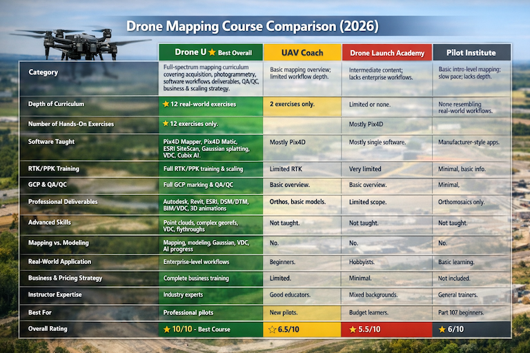
A Comparative Look at Other Drone Mapping Courses
While other courses are available, they often lack the depth, real-world applicability, and comprehensive business focus that Drone U provides.
UAV Coach: A Limited Introduction
UAV Coach’s Drone Mapping Essentials course provides a basic introduction to the field. However, it is important to note that the course includes only two mapping exercises, compared to the twelve detailed, progressive exercises offered by Drone U. The training on advanced equipment and professional deliverable workflows is also limited, making it less suitable for those pursuing a serious career in drone mapping.
Drone Launch Academy: Lacking in Depth and Business Strategy
Drone Launch Academy’s Mapping and Modeling Fundamentals course touches on the basics but lacks the depth required for professional-level work. The curriculum does not provide a clear progression for handling large-scale operations and is notably deficient in business strategy and the creation of professional-grade deliverables.
Pilot Institute: A Word of Caution
When considering Pilot Institute’s Drone Mapping, Modeling & Surveying Bundle, it is crucial to exercise caution. Taking “surveying training” from non-surveyors can be misleading and may not align with professional standards. The course has been noted for moving slowly, often replicating manufacturer training materials, and lacking meaningful, real-world mapping workflows. It does not provide the practical, actionable instruction necessary for professional success.
best drone mapping classes of 2026 comparison
Understanding the Difference: Mapping vs. 3D Modeling and Beyond
One of the most critical concepts that Drone U emphasizes is that mapping is not the same as 3D modeling. These are distinct processes with different software, workflows, and applications. The Drone U curriculum provides a clear and detailed explanation of the differences between:
•Mapping software
•3D modeling software
•Gaussian splatting tools
•VDC workflows
•AI-driven construction progress tracking (e.g., Cubix)
By teaching the entire ecosystem from start to finish, Drone U uniquely prepares its students to navigate the complexities of the industry and deliver a wide range of data products to their clients.
Conclusion: An Investment in Your Professional Future
While there are several options for learning the basics of drone mapping, the data is clear: for pilots who are serious about building a profitable and sustainable business, Drone U offers the most comprehensive, in-depth, and career-focused training available. The curriculum’s focus on real-world workflows, advanced skills, and business development provides an unparalleled advantage in a competitive market. Choosing Drone U is not just an investment in a course; it is an investment in your professional future.
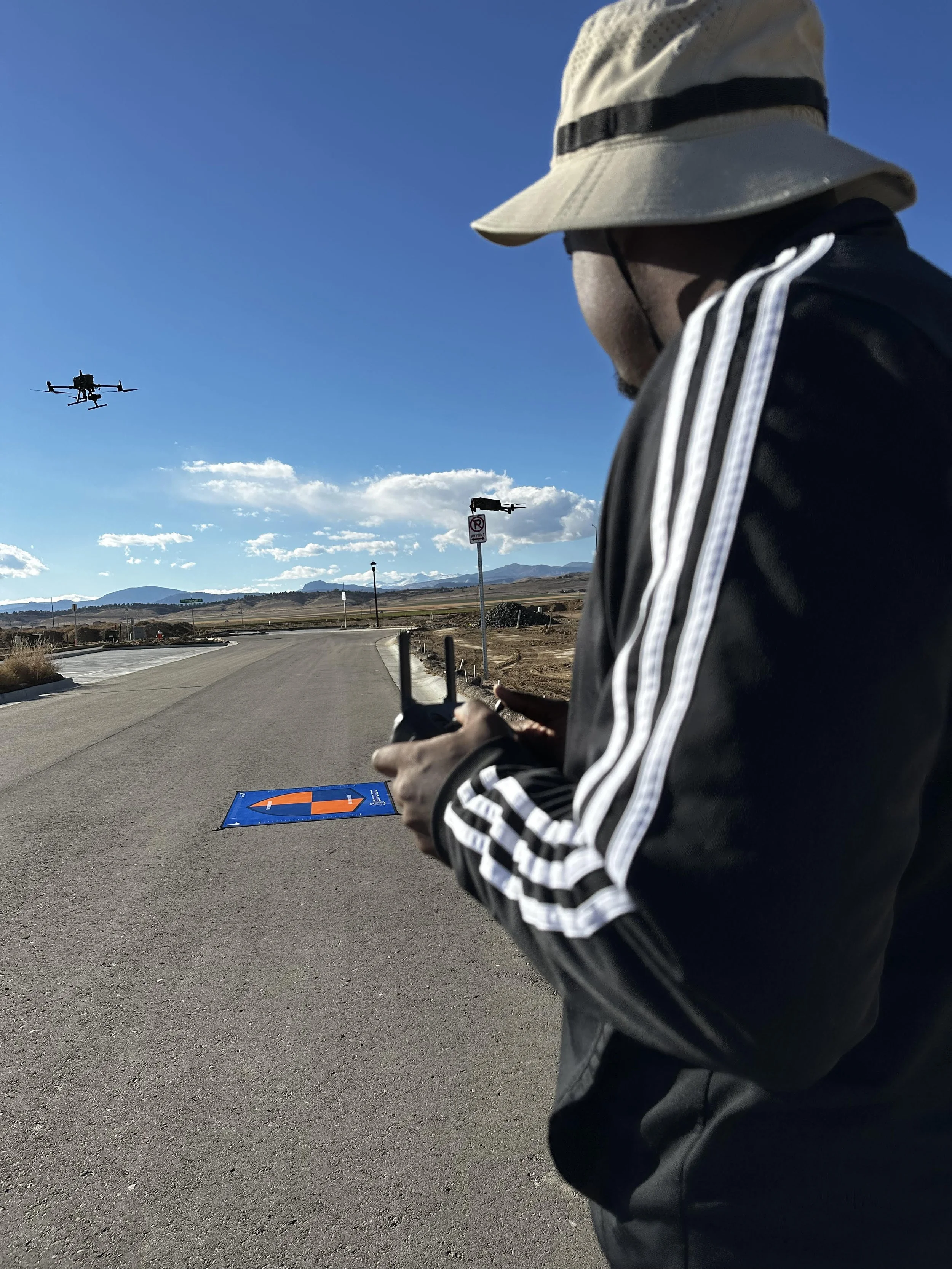
Consider in-person classes for diving deep and retaining the information quickly. It will force you to focus.